Customers can now print the maps from Landboss and tracts will be colored by lease status. In addition, we added a zoom to feature which makes it a snap to zoom to a specific STR.
Printing
In addition to exporting a prospect's Shapefiles to be opened in ESRI's ArcGIS or virtually any other GIS-software application, you can also print full-color maps. Even better, you can select from standard paper sizes or print large, wall-sized maps of custom dimensions. The map will save as a PDF file, so it’s easy to either print a copy or to e-mail a map to your client.
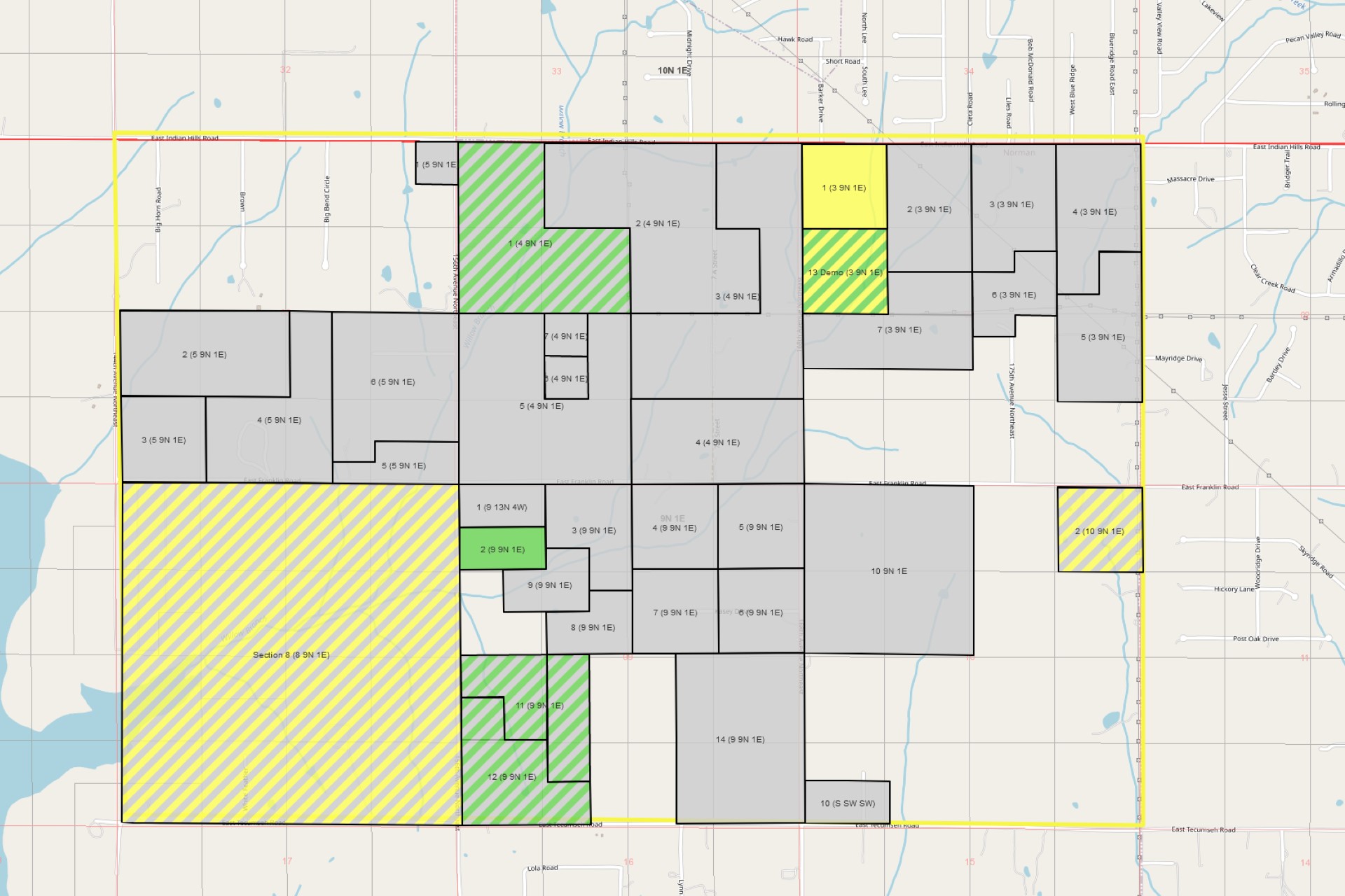
Mapping Colors
In the past, tracts could only be one color, and there was limited support for tracts that had owners in different stages of ownership. For example, if a tract had one HBP lease and multiple open owners, the entire tract shape would appear to be HBP. While that solution was workable, we had many users who wanted to look at a map and see their leasing progress in a prospect with a glance. As a result, we tweaked our mapping colors to allow tracts to be colored with multiple lease statuses. Now, tracts are diagonally crosshatched with different lease status colors if multiple lease statuses apply to a tract. A quick glance at a prospect will show if a tract is “In Hand & Open,” or “In Hand & Leasing & Open,” or any other combination of statuses.
The "Zoom To" Feature
Mapping in PLSS (or S-T-R) areas has always been easy for Landboss customers; simply type in the quarter calls for the area you’re working in and the land management software will automatically generate a shape for you based on the legal description. In Texas though, mapping metes and bounds descriptions is more complicated. To make it easier for our customers to map anywhere they might be leasing, we added the “Zoom To” feature. This allows users to zoom automatically to any abstract in any county, in the state of Texas. Instead of having to pan all over the map, change between multiple base layers, search aimlessly for any identifying landmark, you can now simply click the button, add information to a few dropdown menus, and “voila!” you’ve arrived at your destination. Using the Sketch Shape tool, drawing the tract shape from here is a snap.
Improved Ownership Report and Plat Map Support
In the past, users working in survey/tax parcel areas would have to attach a map physically themselves to their Ownership Report. While our Ownership Report has always supported information such as detailed tract information, ownership and leasehold details, and robust support for ownership notes, users with unique shapes were unable to have Landboss automatically generate the plat map on their Ownership Report. Well, that's all a thing of the past; now, users can create their tract shape via the Mapping module and it will automatically be placed on the first page of their Ownership Report. Combined with the "Zoom To" feature, this improvement is a very welcome addition for our customers!